Autonomous navigation
Hint
The operating environment and software and hardware configurations are as follows:
- PC:Ubuntu (≥22.04) + ROS2 (≥humble)
Configure the map
Autonomous navigation will be completed on the map previously created by SLAM (Gazebo). Before navigation, you need to modify the map to your own environment. The modification method is as follows:
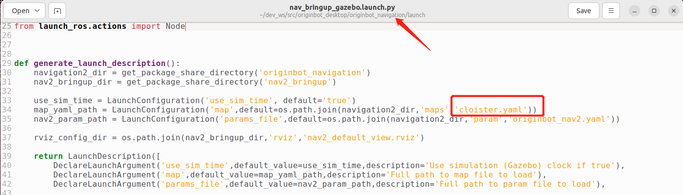
- Copy the map file(*.pgm) and map configuration file(*.yaml)created by your SLAM and place them in the originbot_navigation/maps directory.

- Modify the map name called in the originbot_navigation/launch/nav_bringup_gazebo.launch.py file to ensure that it is consistent with the map configuration file name copied in the previous step:
- After the modification is complete, the terminal returns to the root directory of the workspace and recompiles it.
At this point, the map is configured, and you can use your own map to navigate.
Start the Gazebo simulation environment
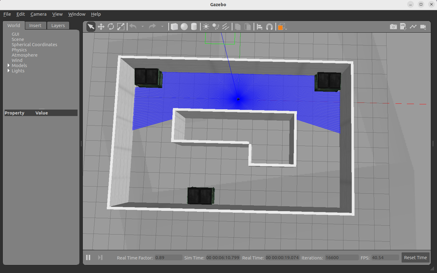
Open a new terminal on the PC and enter the following command in the terminal to start the Gazebo simulation environment:
After a short wait, you will see the simulation environment containing the robot model after successful startup:
Start the navigation feature
Enter the following command in the terminal to start the Nav2 navigation function package:
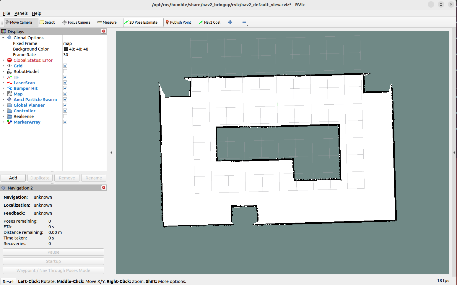
After successful startup, you will see continuous output of information in the terminal. This is because the initial position of the robot is not set. This can be solved by setting the initial position later.
Hint
If you cannot find the Navigation2 plugin here, please use "sudo apt install ros-${ROS_DISTRO}-nav2*" to install it.
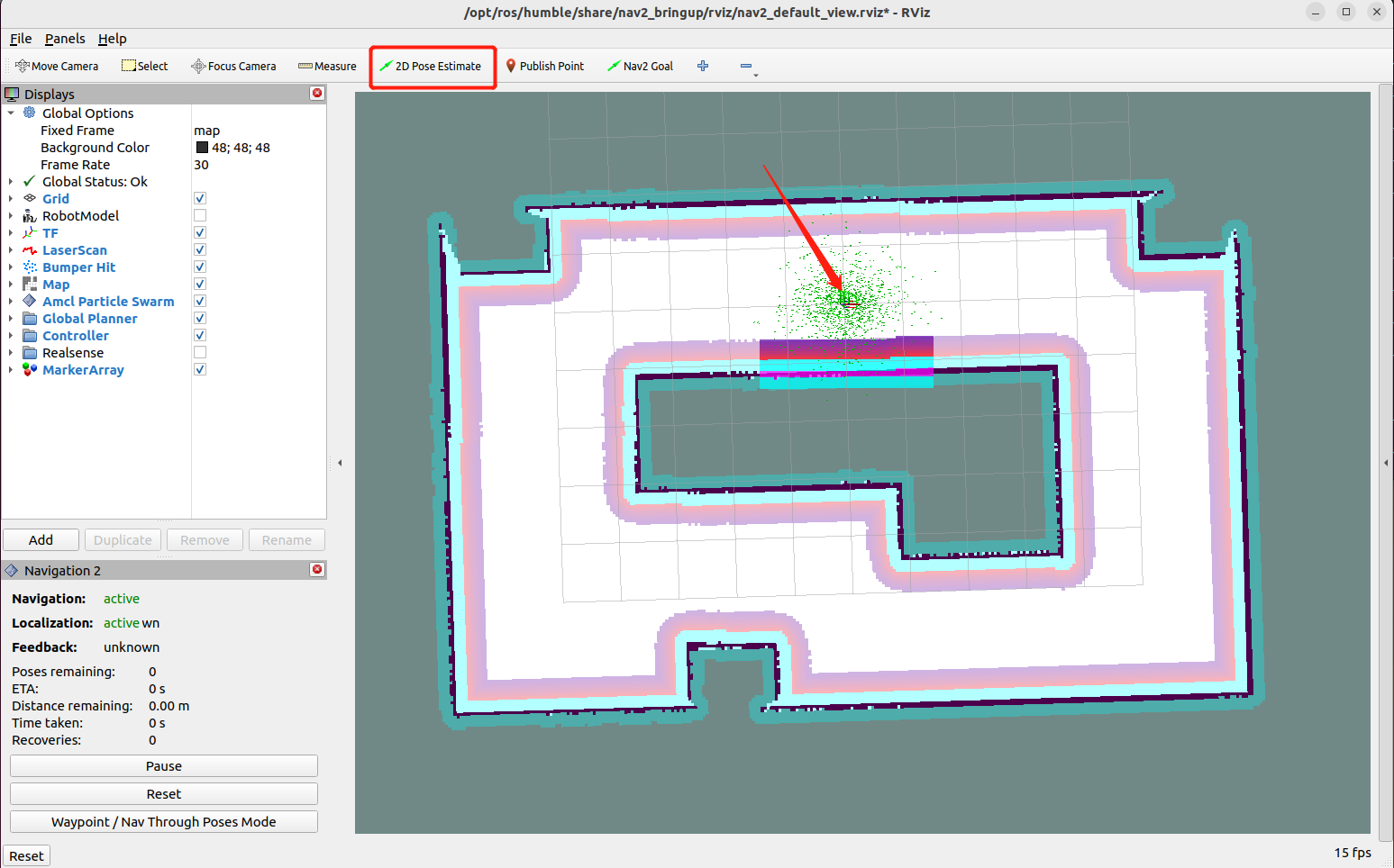
Set the initial position
Configure the display project in the opened Rviz, click the "2D Pose Estimate" button in the toolbar, select the initial pose of the robot in the map, and click OK. The warning in the terminal will stop.
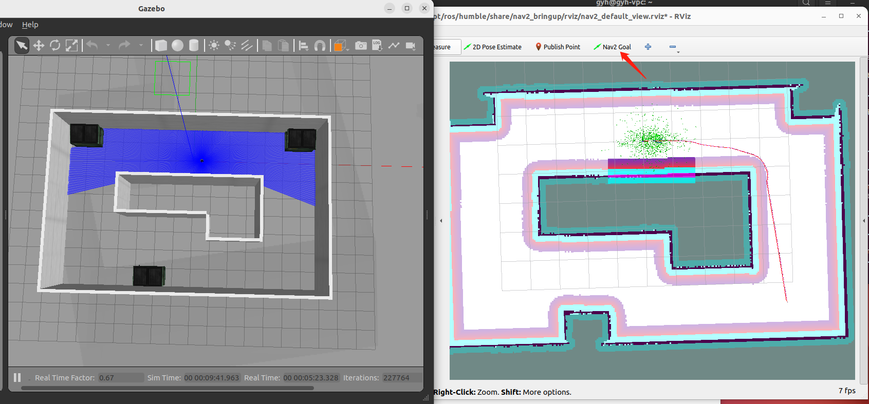
Single-target point navigation
Click the target location and select the "2D Goal Pose" button, and then select the navigation target point on the map to start autonomous navigation.